Monday, October 3, 2011

Day 10.6: The End of the Longest Day Ever...

... and just when you think you can't walk anymore, it's amazing what oxygen and a little downhill (or vice versa) can do for you.

IMG20101012 (192) PANORAMA

The panorama above was meant to show the cool Giant Lobelia (lobelia deckenii) trees in the shadow of Kibo and the nice cloud formations. The false color is just a nice side effect of the process.

(Picture courtesy of UltimateKilimanjaro.com)

So, back to the climb... as you can see from the height profile map I posted previously, day 6 of the climb is ridiculously long. You start at 11PM at 15,430 feet at mile marker 24. From there, you climb for 10 hours to Uhuru Peak at 19,341 feet (and the longest four miles ever), climb down for 4 hours and 4 miles back to Kibo 15,430 feet, eat and take a nap for two hours, and then hike another 4 hours and 6 miles to Horombo Hut. Now, by the time we get back to Kibo Hut, we are pretty much walking zombies. However, a bit of food, oxygen, nap, and roughly downhill makes those 6 miles surprisingly easy.

IMG20101012 (143)

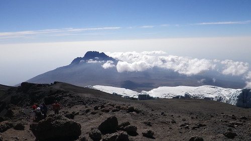
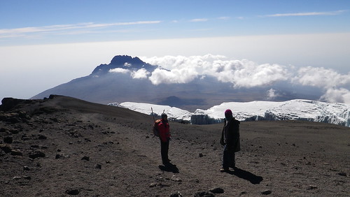
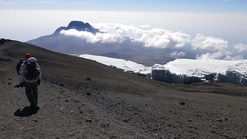
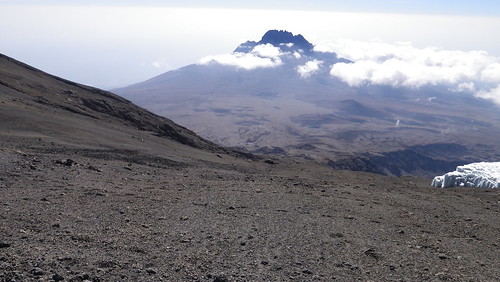
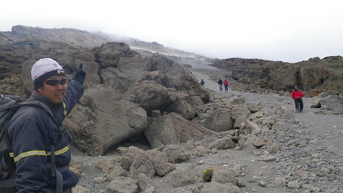
As you can see, the first two miles are ridiculously flat, with Mawenzi just taunting us in the distance. That's Jonas and Modi in front of us. Ronald was still crazy sick by this point (although he did wake us up to tell us to pack - very nice and apologetically - thanks Ronald!), so Modi took over for him... except his English is bad, and he doesn't really know the trails. But he smiles a lot and is a nice dude.

IMG20101012 (148)

Closer view of Mawenzi with clouds overhead providing interesting shadows.

IMG20101012 (146)

Me basking in the glow of the descent, and William just wanting to get it over with. Spoil sport.

IMG20101012 (147)

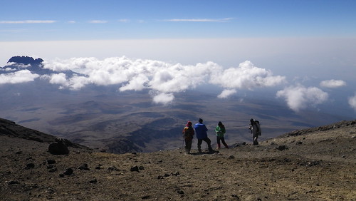
This is looking back at Kibo Hut. The clouds are really starting to come in now, and it has gotten noticeably colder without the sun and some wind has started to blow, which is a bit unusual considering we have had no noticeable wind on any part of the journey up to this point.

IMG20101012 (150)IMG20101012 (155) PANORAMA

This is a closer view and a panorama view of trail threading between Mawenzi and the higher parts of the Saddle.

IMG20101012 (154) PANORAMAIMG20101012 (156) PANORAMA

And this is the 360 panorama with both Kibo Hut and Mawenzi.

IMG20101012 (158)

This sign makes more sense if you are ascending along the Marangu Route. For us, it was still nice to have markers, however, as the Rongai route strangely had a lack of signs. William is starting to feel like a person again.

IMG20101012 (161)

After three days, we come back to the land of vegetation... or at least recently burned vegetation with black rocks.

IMG20101012 (162)IMG20101012 (167)

One thing you will notice on this vegetation is hail. That's right, little ice crystals. I say it with a little bit of a grimace, because I had to greatly curtail my picture taking on the Saddle, because for a good hour of it, there was hail hitting us sideways. Just when I didn't feel headachey from the altitude anymore, the ice took over. Unfortunately, my jacket didn't have a hoodey, so I was reduced to turning my hat sideways to block most of the ice. It kind of worked, but my face still ended up crazy red and raw. Luckily, I was so tired and sore that it didn't really bother me that much.

IMG20101012 (163)IMG20101012 (164)

This sign is also more relevant on the ascent. I guess this is where our porters went to get water at Kibo Hut. It was here that we ran into a bunch of people (Australians, I think) doing the ascent with ski poles. They were pretty tired, especially the ladies. They had worn a lot of layers and were getting warm, and so were contemplating taking some off. We warned them about the hail, however, and so they quickly decided that they could use the "extra padding" later on.

IMG20101012 (165)

The circle in the distance is a helicopter landing pad. I guess after the crashed plane/helicopter we found on the Saddle, this was the closest they could get a helicopter safely, unless it was a true emergency. Every once in awhile, Ronald told us that people had to be airlifted off due to altitude sickness or other issues, which is also part of the reason the fees are so high - something like $7 each day goes to the rescue fee.

IMG20101012 (168)

This was probably the last real uphill we came to, as the Saddle officially transitioned into moorland. We were not happy about it, but it was mercifully short.

IMG20101012 (169)

I'm not sure why Resha is sticking her tongue out.

IMG20101012 (175)IMG20101012 (178) PANORAMA

And we look back again at Kibo, now encased in the hail cloud, and how far we have come. Hard to believe we were at its base only like two hours ago.

IMG20101012 (181)

The clouds are pretty magical at this point... and I am non-delirious enough to really enjoy it.

IMG20101012 (183)

This is the first of the really tall Giant Lopelia trees we got close to. As you can see, I am doing my best California treehugger impression. It grows by the leaves at the top dying and then getting pushed lower while the new leaves on top keep growing.

IMG20101012 (184)IMG20101012 (196)

The clouds broke a little toward Mawenzi, so we could still make it out in the distance.

IMG20101012 (187)

But in our immediate surroundings, we entered treeland, which was a sight for sore eyes.

IMG20101012 (189)

Me doing my thing.

IMG20101012 (192)

Lopelia trees as far as the eye can see. Pretty cool.

IMG20101012 (197)IMG20101012 (199)

We're getting pretty near Horombo Hut at this point, and as you can see, I still think people are crazy for wanting to go all that way to Kibo Hut from this point.
IMG20101012 (201)

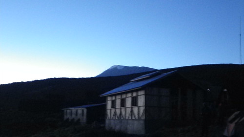
We finally reach Horombo Hut, which is actually a bunch of huts. But more on that next week.

IMG20101012 (200)

For now, we watch the sun descend over the gentle slope of the mountain and the Tanzanian plane. Magical...

Tuesday, September 27, 2011

Day 10.5: Sweet, Sweet Gravity...
... and the primer on how to run down a mountain.
IMG20101012 (101)

We spent about 20 minutes at the top, where we definitely felt light-headed. Still, we were determined to take our pictures, so we did that, and then finally, and somewhat reluctantly, we started to head down.

IMG20101012 (102)

We had probably walked about 30 minutes, when I realized something...


As you can see, however, despite not taking the video at the top, there was no way in heck that we were going back even 20 minutes. We knew when we were beat. Nevertheless, this is still a video from over 19,000 feet. Pretty coherent for that height.

IMG20101012 (105) PANORAMA

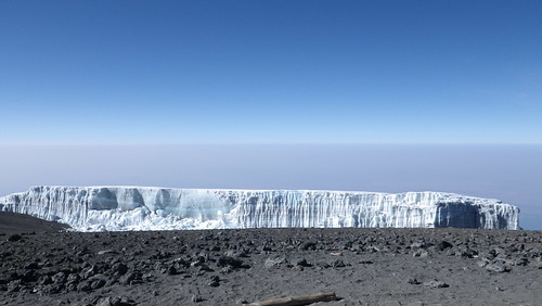
So, we said goodbye to the glacier (we think Ratzner glacier) and began our descent. Or so we thought.

IMG20101012 (106)

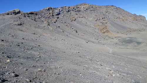
We had actually forgotten that around the crater rim on our ascent, it was mostly flat, with some uphill, but also so downhill. Hence, on our descent, it was mostly flat, with some downhill, but also some uphill. And let me tell you... after psychologically telling yourself that you were done with the uphill when you reached the top, to have some uphill facing us on the downhill was almost too much to bear. It's at that point that my body gave up, and I got a full on headache... the worst headache I have ever had. It felt like a blood vessel was about to pop somewhere in my brain and give me an aneurysm which, given the altitude, was not out of the realm of possibility. I had to concentrate most of whatever energy I had left to not keel over, but instead put one foot in front of the other. It sucked.

IMG20101012 (107)

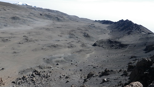
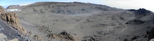
And the ugly crater in the unflattering sunlight of midmorning definitely didn't help. Remember that path through the crater I told you about where people camped? Well, you can kind of make it out from the bottom left of the photo going to the center right where it meets up at Gilman's Point. As I said before, it's a long way down to the bottom.

IMG20101012 (109) PANORAMA

More ugly crater panorama.

IMG20101012 (111)

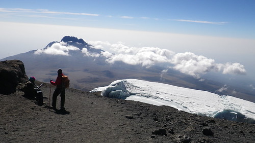
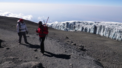
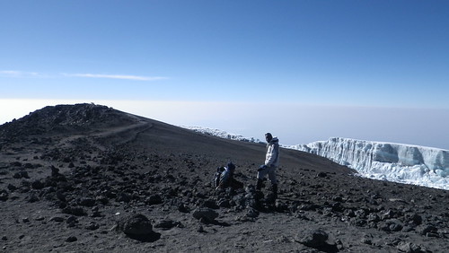
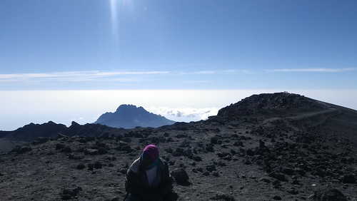
At this time, the clouds are starting to move in, so we need to get going. We come back to the nice view of the glacier and Mawenzi Peak for the last time.

IMG20101012 (112)

Taking a break on the path. First Resha...

IMG20101012 (113)

... and now William...

IMG20101012 (114)

... and Jonas. Resha is using the walking poles at this point, but I find them to be more effort than they are worth, despite the assistance in balance, and besides, I have already broken mine. Luckily, they were extra ones that Ronald brought with him for us, as none of us had brought them to Africa, so that was both nice of him, but ultimately unnecessary for me.

IMG20101012 (115)

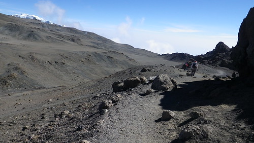
This is roughly the halfway point with, once again, looking down the Machame route down to Barafu Camp. Man, what we would have given to descend here, instead of more horizontal walking.

IMG20101012 (116)

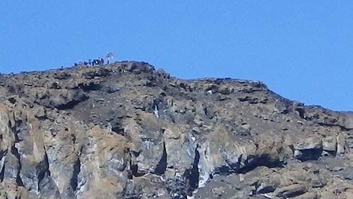
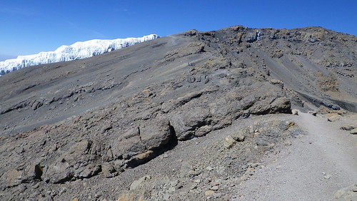
Looking back, you can see Uhuru Peak at the end of the cliff on the right side. The middle peak seems a little better, but that's just the perspective... the right peak is actually the peak, and although you can't make out the people at the peak, trust me... they are there.

IMG20101012 (131)

Oh wait... there they are!

IMG20101012 (120)

And while I was taking those photos, Resha and William had gone further down the path. Even though they had only gone about 20 meters, I was actually jealous that they had already gone that distance.

IMG20101012 (121)

Some guides hanging out before descending down the Machame Route to Barafu Hut. As you can see, it's pretty steep and scenic here.

IMG20101012 (125)

And then we came to a dread uphill of like five meters. It took us like twenty minutes to get over this part. To get to where William is, I probably stopped like twice.

IMG20101012 (126)

Buh-bye Machame Route. I think I took a picture to have an excuse to stop walking. I can't really do justice to how awful we feel right now. Resha is still reasonably good, but William is as bad as I am.

IMG20101012 (126) PANORAMA

Last panorama at the top looking down the mountain. Bye bye Uhuru Peak.

IMG20101012 (132)

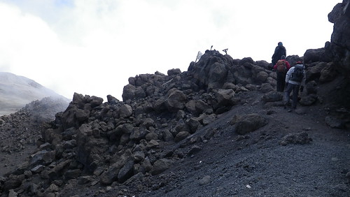
The wooden cross-like think you see is Gilman's Point. We've almost made it!

IMG20101012 (136) PANORAMA

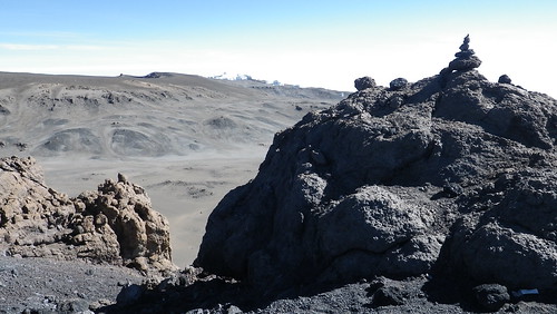
Last panorama at the top, this time of the central caldera.

IMG20101012 (137)

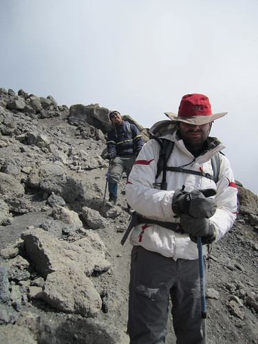
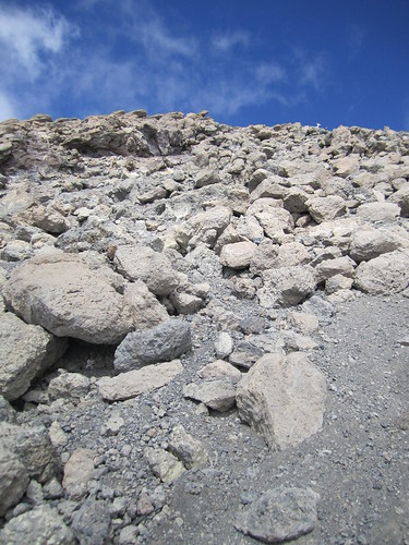
And so we began descending the rockpile or gravel pit on the outer face of the mountain. Now, you would think that when I said before that you would sink into the ground every step you took, that this would be a plus on the descent. After all, you descend faster right? Well, the problem in that theory is that we are bone tired and have no balance. So, each step was still excruciating - probably not has bad as the descent, but annoying in that something you take for granted, such as balance, is so difficult here. As you can see, William is most definitely NOT happy at this point. I am putting on a brave face for show... trust me.

IMG20101012 (138)

Looking back up at Gilman's. Can't see the sign anymore. This was also the point where we saw some porters jump over the edge of ridge onto the rocks, carrying stuff from the central crater camp, and then run down the rocks. Show offs.

IMG20101012 (140)

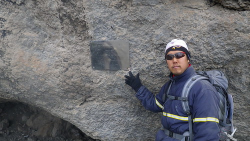
This is a monument to Hans Meyer, the first European to summit Kilimanjaro in 1889. It's a but unclear whether an African climbed to the summit prior to that. The answer is "probably," but there is no record of it, and since there really was no good reason to do it other than to "do it," many of the locals don't see the appeal. And neither do a lot of other people I know. I guess I am the crazy one.

IMG20101012 (141)

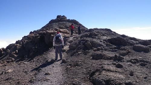
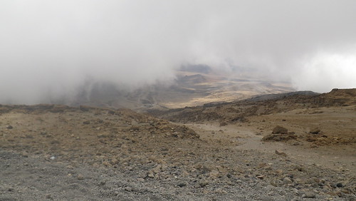
As we keep descending, the clouds have moved in, but we see a break to see Kibo Hut... beautiful, beautiful Kibo Hut. At this point, some of the porters had come to meet us, possibly to carry or stuff, and they genuinely seemed glad to see us. As the oxygen increased as we descended, our muscles still hurt, and their was fatigue, but my headache started to go away, and I breathed easier. I finally felt like I would make it to the end.


Our guides and the porters actually suggested that running was better, since it somehow provided a surer footing when you didn't try to completely balance every step. I could only do it for a few seconds since I was tired, but William was able to do it for long stretches, as seen in the video, and it did indeed seem to work.

IMG20101012 (142)

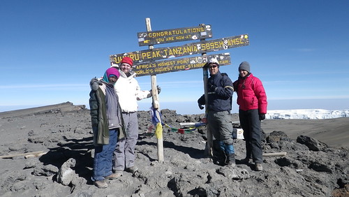
This is at Kibo Hut, and well, at this point I feel completely crappy, so I tell Kibo to take a hike in a not-so-polite way. But we did it... we were at least for a minute the highest people in Africa, scaled one of the Seven Summits, and did something that will be with us all of our lives.

At Kibo Hut, we were given delicious mango juice, a warm welcome by everyone, and Goodluck had made us a delicious lunch of chicken, potatoes, carrots, celery, and rice. I ate first, and then fell asleep, while Resha and William did the opposite. He actually admonished me to eat more, but after about half a bowl, I couldn't fight off the fatigue any longer. So, I slept... soundly... for about an hour before we had to get moving again. More about that cruel joke next week...

Tuesday, September 6, 2011

Day 10.4: Postcards from the Roof of Africa...

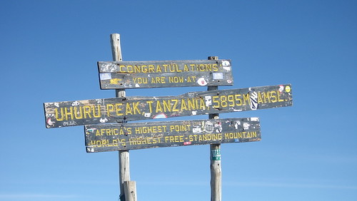
... Uhuru Peak of Mount Kilimanjaro. 19,340 feet or 5,895 meters. For a moment, we were the highest people in Africa. Huzzah!

IMG20101012 (087)

After four days of "enhanced walking" and one day of brutal climbing, we reached our objective. Our emotions when we reached the summit were interesting, in that our outwards appearances did not reflect our inner sentiments... sort of. Inside, I was personally ecstatic. When we finally stopped ascending and reached the flat plateau at the top about 50 meters from the sign, I immediately threw off my pack and "walked briskly" over to the sign to touch it. Outside, I was severely winded from that last bit of "brisk walking," and I started getting a bit light-headed. Up to that point, I had been pretty fine physically, aside from fatigue, but it seemed like my body was saying to me "alright, I got you here. The rest is up to you." Deal.

One common theme William and I had heard from people who had climbed to the summit was that they wished they had taken more pictures. They said that when they reached the summit, they felt so weird and were so fatigued that the only thing they could think about was getting down. So, they took maybe a picture or two before descending into oxygen heaven. Perhaps partly because we had kept this mind our entire journey, and perhaps partly due to stubbornness, we were determined to get our fill of pictures. And get our fill we did.

IMG20101012 (065)

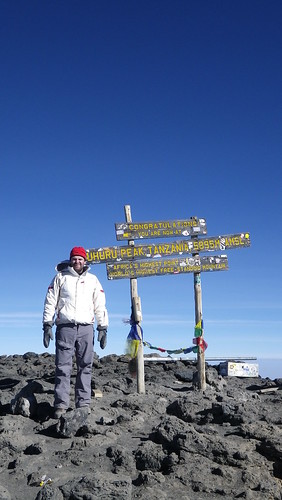
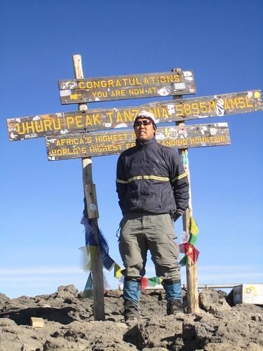
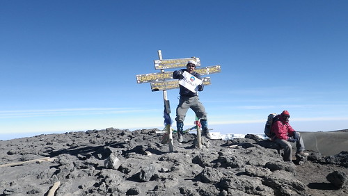
It was first William's turn to play Vogue model. I kind of bummer was the tattered flag ribbons and random metal bar with box in the background. It kind of made some of the shots weird, but no way in heck we were going to waste energy moving them.

IMG20101012 (064)

He certainly felt well enough to remember to make a Cornholio appearance. Related note, did you know Beavis and Butthead is coming back?

IMG20101012 (073)

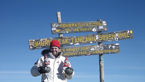
And of course, the gnomes. I don't think I am going out on a limb when I say that this is the highest that the Virginia Tech and Maryland gnomes have ever made it... or for that matter, any gnome from the new and expanded ACC.

IMG20101012 (066)

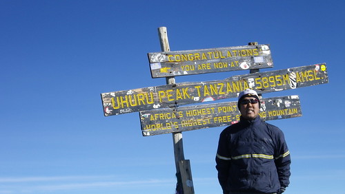
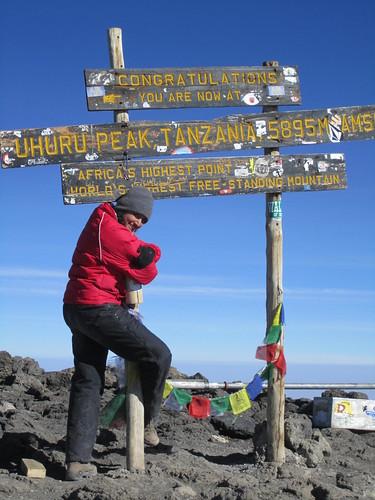
I was next. I don't know exactly what that expression is, but I think it was mostly frozen face. I am happy on the inside... really!

IMG20101012 (067)

From another, worse angle.

IMG20101012 (069)

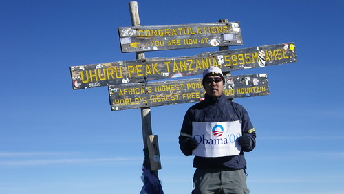
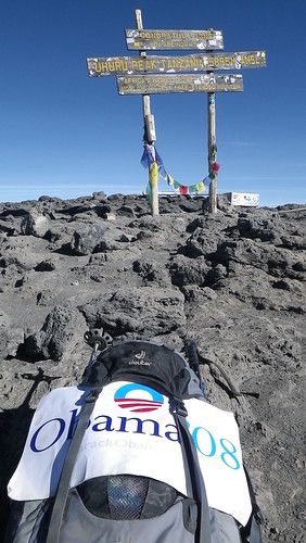
I also don't think I am going out on a limb by saying that this is the highest Obama yard sign (or really any U.S. campaign yard sign) ever. I do hesitate to say highest political yard sign ever, since a "Mao in 66!" probably made it somewhere in the Himalayas. Or something like that.

IMG20101012 (070)

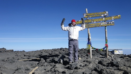
There is a back story to this one. Back at wonderous sea level prior to our journey, I had conceived of this great plan to replicate my moves made on top of a rock in Chesler Park of the Needles District of Canyonlands National Park in Utah.


So, I had dutifully loaded my crappiest MP3 player with appropriate tunes, brought my no-battery needed speakers, and taken it to the summit with the full intention of busting out the running man and lawnmower once again. Alas, when I got to the top, I realized that gettin' jiggy wit it at that pace would have made me collapsed. So, I settled for the jumping shot above... which still took all of my energy as it knocked the wind out of me.

IMG20101012 (071)

And finally, we have Resha. She really was as fresh and springy as the picture above shows, with Brutus.

IMG20101012 (072)

In fact, she was the most appreciative of all making it to the top, as evidenced by the above.

IMG20101012 (078)

This is looking back at both the glacer and the road we came on, which winds to the left. The guy sitting down is our guide Jonas, hanging out with another guide for the french group that summitted about the same time we did. They came from the Machame Route.

IMG20101012 (079)

Jonas with Mawenzi in the background. Again. I think I have a Mawenzi addiction.

IMG20101012 (077)

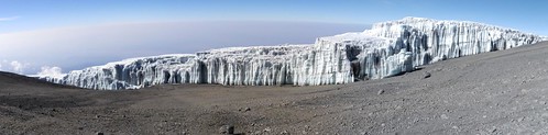
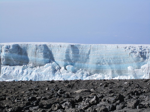
Great picture of the closest glacier and its ice profile.

IMG20101012 (074)

Even closer photo. The deep blue in the glacier was amazing.

IMG20101012 (091) PANORAMA

A panorama of the whole glacier.

IMG20101012 (078) PANORAMA
IMG20101012 (081) PANORAMA
IMG20101012 (082) PANORAMA

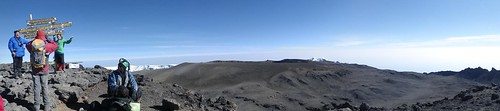
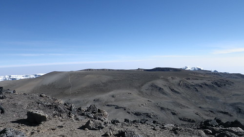
And different panoramas of the summit, with the central cone to the right on the top photo. Behind the sign is actually a steep ridge drop of about 200 meters.

IMG20101012 (082)>

You can see the falloff a little better here. And the central core is still ugly.

IMG20101012 (099)

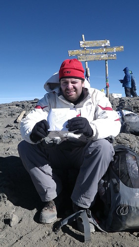
This was kind of cute. So, William's girlfriend (now fiance) Bonni had written and sealed a letter for every day William was going to be in Africa and Dubai. And William dutifully opened a letter on every day. Bonni even included one specifically for when he summitted (guess she knew something even we didn't know), so the above is William opening that particular letter. As you can see, he is beside himself with joy.

IMG20101012 (096)

What a long, strange trip is has been, Barack.

IMG20101012 (101)

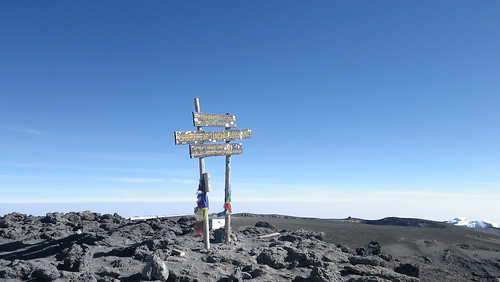
The sign by itself, in case you couldn't actually read it before.

IMG20101012 (093)

And with that, we say adieu to Uhuru Peak, a culmination of almost a year's worth of planning. See ya Kilimanjaro. We hardly knew ya... and we have no interest in coming back.

But don't think this blog is over folks. While this is perhaps the culmination, there is still more to come... like the very, VERY interesting descent. Until next week...