... or Loitoktok. No matter which name you choose, they all go to the top of Kibo!
To make sense of all of these names, I designate today map and chart day, as I will go into the analysis of why we choose the particular route we did to get to the top of Kilimanjaro.

(Map courtesy of GrantToursandTravel.com)
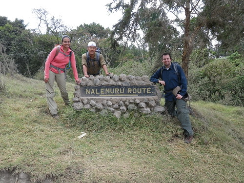
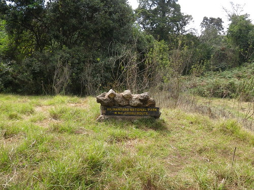
In my previous post, we had just arrived with Ronald (main guide), Jonas (second guide), Goodluck (cook), and Modi (waiter) at the Rongai gate and met the rest of the crew. Rongai is at the upper right corner of the above map. All the routes get their names from the towns from which they begin, so the Rongai route (naturally) begins near the town of Rongai, and if you follow the trail further, crosses into Kenya to the town of Loitoktok. As the years have progressed, however, the location of the start of the trail has changed slightly such that the route now officially begins in the town of Nalemuru. This is why the sign in the photo at the top says Nalemuru. Regardless, you can call the trail by any of those names and the local people will know what you are talking. However, since most companies still use the old names, I will refer to this as the Rongai route.

(Map courtesy of www.AfricanOverlandTours.com)
Before I talk specifically about the Rongai route, however, I need to go into the other routes, and particularly the more popular ones: Marangu and Machame. To give a general overview, the Rongai route goes up the purple route and down the blue route, the Marangu route goes up and down the blue route, while the Machame route goes up the red route and down the yellow route.

(Map courtesy of www.AbsoluteKilimanjaro.co.uk)
Another way to look at the mountain and the routes are set forth above, with an elevation overlay. The elevations, and particularly the day-to-day elevation changes, are EXTREMELY important in choosing a route.

(Map courtesy of ZanzibarMagic.com)
By far the shortest, cheapest, directest, and popularest route is the Marangu route. Please note I did not say it is the EASIEST route. When doing high altitude climbing, easy takes on a whole new meaning. The route begins at the Marangu gate on the southeast corner of Kilimanjaro. It is the main gate of the park where pretty much trekkers on all routes check-in. It is nicknamed the "Coca-Cola" route because supposedly anyone who can drink Coca-Cola (from children to the elderly) can do this route.

(Chart courtesy of UltimateKilimanjaro.com)
The "basic" version of the Marangu route has the following itinerary:
- Day 1: Marangu Gate to Mandara Hut. A 5-mile hike and 2,800 feet elevation gain.
To give you an idea of the heights, you begin the day at the altitude of Mount Washington, the highest point in New Hampshire, and end the day the height of Guadalupe Peak, the highest point in Texas (near El Paso). In between, you hiked the entire altitude of Mount Magazine (Arkansas).
- Day 2: Mandara Hut to Horombo Hut. A 7-mile hike and 3,400 feet elevation gain.
We are now at the height of Humphrey's Peak, the highest point in Arizona (near Flagstaff). In the process, you leave in the dust the highest points of Tennessee (Clingman's Dome), North Carolina (Mount Mitchell - highest point east of the Mississippi), and Oregon (Mount Hood), and are about on par with those of Idaho (Borah Peak) and Montana (Granite Peak). You climbed the entirety Backbone Mountain (Maryland) from the Chesapeake Bay.
- Day 3: Horombo Hut to Kibo Hut. A 6-mile hike and 3,200 feet elevation gain.
At some point on this day, you blow past the height of Colorado's Mount Elbert, the highest point in the Lower 48 (and indeed of the entire Rocky Mountains). Other victims include Mount Rainer (Washington), Mount Whitney (California), Boundary Peak (Nevada), Gannett Peak (Wyoming), Wheeler Peak (New Mexico), and (surprisingly) HAWAII (Mauna Kea). You went the entire length, from sea level, of Mount Davis (Pennsylvania).
- Day 4: Kibo Hut to Uhuru Peak to Horombo Hut. A 4-mile, 3,900 feet ascent to the top, followed by a 10-mile, 7,100 feet descent.
- Day 5: Horombo Hut to Marangu Gate. A 10-miler with a 6,200 feet drop.
Now, for some people, this route is going to be very tempting, especially for those who want to just get there and take a picture to say they had been there, without enjoying the ride. Korean tourists are notorious for this. However, as I will explain, all of the supposed "strengths" of the route are weaknesses. And after that there are some weaknesses, that, in fact, are weaknesses. In other words, don't do this route.
- Strength #1: It's short.
It's short alright. In fact, it's so short that you are guaranteed to fail. This is because this itinerary leaves no time for your body to get acclimated to the altitude. While you can add extra days to acclimate, this, of course, works against it being short. I'll do a detailed post about altitude acclimatization in another post, but suffice it to say that this is by far the most important reason not to do this route. And the numbers bear out. Officially, less than 50% of climbers on this route make it to the crater rim, and I think the actual number is less than 30%.
- Strength #2: It's cheap.
See Myth #1. Most of that applies, particular if you add extra days, PLUS, as I mentioned in my previous post in choosing outfitters, do you really want to trust people who are going to sacrifice things (like, oh, SAFETY) to save a few bucks? While you will be fine if you are careful, there are fatalities. So, take my advice, and don't do this if finances are remotely a concern.
- Strength #3: You get to sleep in huts.
It's true, you do get to sleep in huts (and bunks) as opposed to in tents. Here are some of the huts.
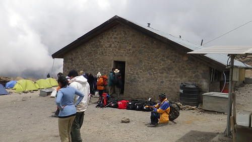
The top one is at Kibo Hut, the middle one is at Horombo Hut, and the bottom ones are at Mandara Hut. And to clear up some confusion, while the various "huts" do have one particular "hut" that it is named before, they more denote locations. So, at "Kibo Hut," there is indeed one "Kibo Hut" (usually where park officials live/work), but there are also a bunch of other huts there as well.
Anyways, while huts (and beds) may seem appealing at first, here are the downsides. First, they are nicknamed "rape huts." Now, before you get your panties all in a bunch (where does that saying even come from?), this is more of a historical nickname, as I saw plenty of women and families staying in the huts. Nevertheless, that is what they are nicknamed.
Second, the reason sexual assault is much less common now is because you sleep a bajillion people to a room. No matter how much you pay, there are no "private rooms" in these huts. Indeed, tents offer infinitely more privacy than the huts.
Third, due to the bajillion people staying in them, they stink. Maybe not bathroom stink (more on that in a future post), but "thousands of people's BO sinking into mattresses that don't get replaced" stink.
- Weakness #1: It's crowded.
Because it is the most popular, you will not have a moment to hear yourself think on this route. Well, maybe a stretch on the trail here and there in the non-busy season, but it's pretty much people, people, everywhere, and not a... well, you get the idea. And the reason it is crowded is because of all of the strengths set forth above, which can mean only one thing: lots of annoying people who shouldn't be on this trip.
- Weakness #2: Same routes up and down.
Self-explanatory. Which brings us to the final "strength"...
- Strength #4: It's pretty.
It is nice in that you get an equal taste of each of the climate zones (jungle, moorland, alpine desert, high elevation), but everyone says the most beautiful routes are along the south and southwest side of Kilimanjaro, which brings us to the Machame route...
(Map courtesy of www.AfricanOverlandTours.com)
Nicknamed the Whiskey route, the Machame route is pretty much every guide's favorite route. Starting on the southwest corner of Kilimanjaro, you make your way north up one of the valleys to the crater rim, and then come back down the Mweka route. Ronald said it was his favorite route because you get the most varied terrain, you get to see three sides of Kibo, and you enter the crater at Stella Point, where the trek to Uhuru Peak (the actual highest point) is much shorter than the Marangu route (and Rongai route), which enters the peak further east at Gilman's point.

(Chart courtesy of www.gdbnet.de)
(Chart courtesy of UltimateKilimanjaro.com)
Compared to the Marangu route, the main differences (other than those set forth above) are that it is one day longer, the initial ascent is faster, and there is a bit of inefficient climbing, in that you backtrack in elevation a bit. If I had to do it all over again (and I most emphatically do NOT), I would choose this route. There are some other, longer routes, particularly the Lemosho and Shira routes which start further east and enter Kibo over the Shira plateau, but I think the Machame is best of all worlds.
One of my friends did the Umbwe route and swears by it for being magnificently beautiful. Aside from length of trek, it is widely acknowledged to be the most difficult route. After talking to people in our crew, however, I think difficult is a misnomer because what they mean by that is while you ascend quickly, the ascents are very short and you still don't need equipment. Think of it as climbing on a stairmaster as opposed to a slightly inclined treadmill. So, I don't think it's particularly physically challenging compared to the other routes.
But of course, we didn't choose any of these routes. We chose the Rongai route.

(Chart courtesy of UltimateKilimanjaro.com)
There are, of course, several reasons we did this.
- Reason #1: It actually IS the easiest climb.
This is because it has the most gradual ascent of all the routes, and thus is the best suited for proper acclimatization.
- Reason #2: It's the driest.
People do climb Kilimanjaro during the rainy season. And they are dumb. Why you would want to make a difficult journey wet and yucky also is beyond me. And at a certain point in altitude, the rain turns to snow, meaning you can't even take good pictures. This was one of the mistakes tennis great Martina Navratilova made when she failed to reach the summit. And of all the sides of Kilimanjaro, the southwest is the wettest (and a reason why it is the prettiest) while the northeast is the driest. Where the Rongai route is!
- Reason #3: It's less crowded...
... although Ronald told us the route is becoming more popular for the reasons mentioned above. Plus, for awhile there were border skirmishes with the Kenyans (or was it Kenyans separatists?), so the route was closed for awhile. One time, they even had to hide people in caves because the separatists were taking Western hostages. To their credit, they got them out safe.
- Reason #4: It has Mawenzi.
As I mentioned in my first post, Mawenzi is one of the three peaks of Kilimanjaro, and it is a prominent way station on the Rongai route. Plus, we paid for an extra acclimatization day, and our day would have been around Mawenzi. As it happened, however, Ronald suggested adding the extra day earlier in the route, and, of course, we acquiesced to his expertise.

(Map courtesy of CopsOnTop.org)
As you can see on all the maps, there are actually several options for each route that you can take to the top. For the map immediately above, we took the Rongai route to the left.
So, our day-to-day itinerary went like this:
- Day 1: Rongai Gate to First Cave Camp. A 4-mile hike and 2,900 feet gain.
- Day 2: First Cave Camp to Second Cave Camp. A 4-mile hike and 2,000 feet gain.
- Day 3: Second Cave Camp to Kikelawa Camp. A 2-mile hike and 500 feet gain.
This was the additional day. Otherwise, we would have gone straight from First Cave Camp to Mawenzi Tarn. For acclimatization purposes, it was enough, however, that we were above 11,000 feet.
- Day 4: Kikelewa Camp to Mawenzi Tarn. A 4-mile hike and 2,300 feet gain.
- Day 5: Mawenzi Tarn to Kibo Hut. A 6-mile hike and 1,300 feet gain.
- Day 6: Kibo Hut to Uhuru Peak to Horombo Hut. A 4-mile, 3,900 feet ascent to the top, followed by a 10-mile, 7,100 feet descent.
- Day 7: Horombo Hut to Marangu Gate. A 10-miler with a 6,200 feet drop.
Wow that's a lot of text. Okay, some pictures of this (relatively) uneventful day.
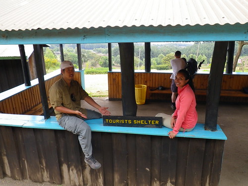
This is the tourist shelter where we hung out while Ronald got all of our permits and the crew figured out the logistics of who would carry what. As I said in my previous post, the divide between tourist and local was very noticeable on our climb, beginning with this shelter. Here, we met three very nice middle-aged British men from London who had taken a quick vacation away from their wives and kids to climb Kilimanjaro. Unlike us, they were on a tight schedule. They flew in that day, were going to climb Kili, and then fly out right after. Ouch.
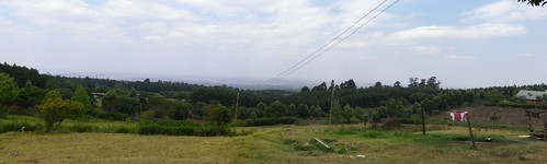
This is a panorama of the countryside north of Kilimanjaro and into Kenya. I didn't know this before, but apparently farmland is generally at a lower altitude than jungles.
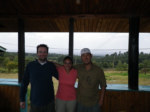
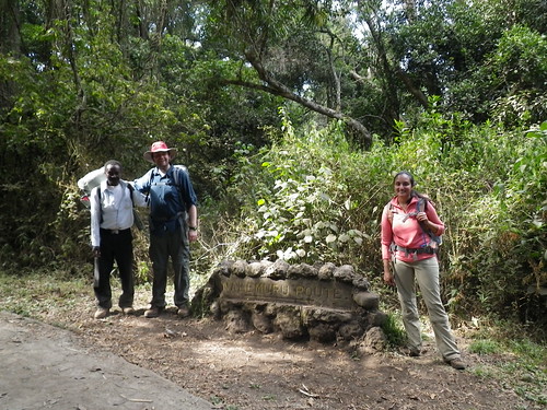
Our before picture taken by the Brits.
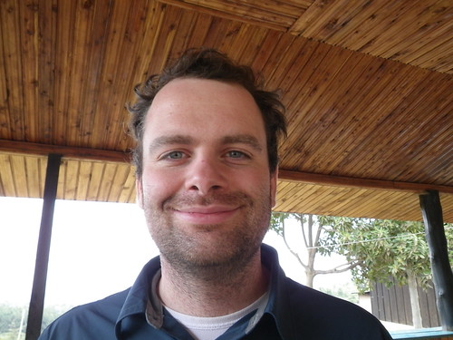
As you can see, William is very happy at this point.
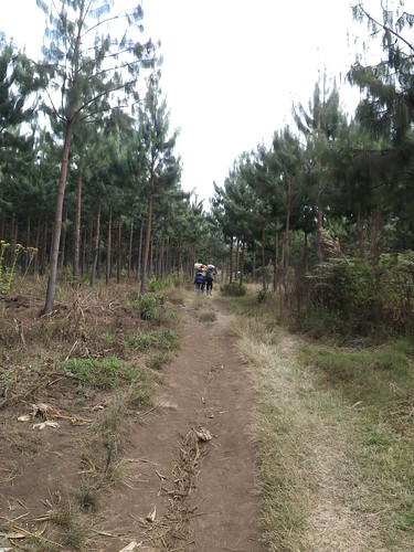
Various signs, as we begin our trek.
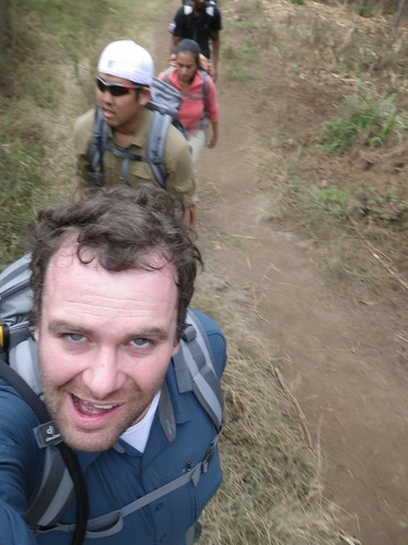
And we're off...
... with the non-guide portion of the crew already leaving us in the dust.
Until next week...
I thought Whitney was the highest in the lower 48...
ReplyDeleteThe Marangu route is usually the easier on for first timers but also the highest in traffic. Marangu Route Mt Kilimanjaro Ascent
ReplyDelete