I am sorry I have been delinquent these past two weeks. Between work, attending a four generation family reunion at Woodloch Resorts, and Mexico City, been a great, but busy, couple of weeks.
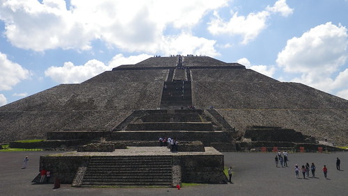
The highlight of my Mexico City trip was definitely Yavin 4...
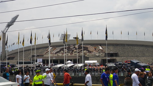
... but the soccer game was a close second.
I have never seen more riot police in one place...
... even when I was living in Korea during the Democracy riots. You see the line of riot police in the above photo? It went around the entire stadium.
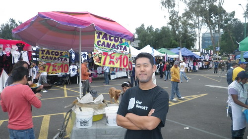
And did I mention the food?
You read that right. That's 7 tacos for $1 (10 pesos). Thankfully, Montezuma's revenge did not make an appearance.
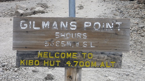
And since everyone has been so great, here is the most spectacular video I took on Kilimanjaro...
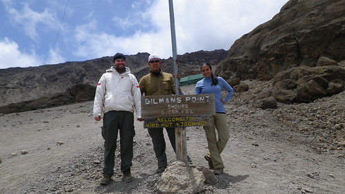
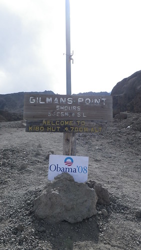
... the sun rising over Gilman's Point (the rim of the crater, but unfortunately NOT the summit). I will explain how we got there next week...
... that's at 15,420 feet for the metrically challenged (or lovers of the extremities of English kings).
Only one update this week. Sergey is back from Africa! Bittersweet for him, but good for me as I'm excited to hear his tales.
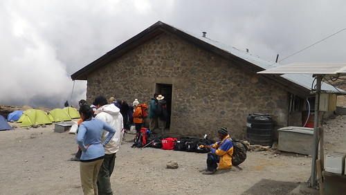
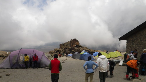
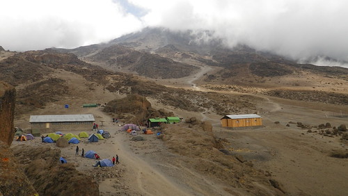
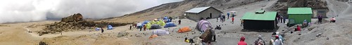
Anyways, we made it to Kibo Hut, which is pretty much the base camp for the rest of Kilimanjaro. Between Kibo Hut and the summit at Uhuru Peak (by way of Gilman's Point), there is nothing resembling civilization except 1,100 meters of dirt and rock.
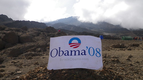
Barack is excited as well.
Above is the first real sleeping hut we have seem for trekkers. As I covered in a previous post, this is a part of the "Whiskey" and "Coca-Cola" routes where trekkers don't have to sleep outside. The outside looks solid enough, but inside is kind of a B-O heavy bunkbed central. Because we were combining with those other routes, however, the number of people we encountered easily tripled.
As you can see, we set up right beside the sleeping hut, as the tent setting area is actually fairly small. This made things pretty loud, and since trekkers leave to summit in the middle of the night, there is a fair buzz going on at all hours. However, we were so tired that we didn't really notice. Resha and William pretty much immediately went to sleep, as we had to get up in about 10 hours. I couldn't just go to sleep, however, and not take the opportunity to explore this area, so I fought off sleep and wandered around, hoping I didn't regret this.
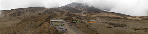
Here is an aerial view Kibo Hut at the base of Kibo peak. Pretty cool aye! I took the above picture from on top of a rock facing almost due west.
Here is the view from the same point facing due east, where we came from. As you can see, the path on the middle left just disappears into the clouds of the Saddle.
Here is a view of that same path taken from a different angle. The above photos were taken from atop that rock in the middle. It looks deceptively flat, but it easily gains a couple hundred feet before the cloud.
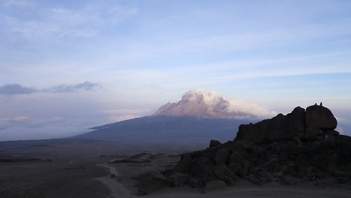
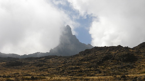
I actually don't remember taking this, but this is a picture of Mawenzi in the distance, where we had hiked from the previous day. The clouds have most burned off just long enough to give us this magnificent view.
Still my favorite peak. Looks way more majestic than Kibo below.
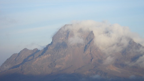
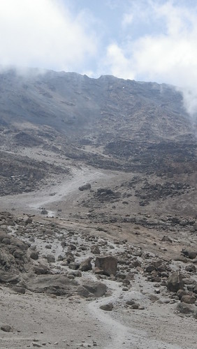
That's Kibo. Looks more like a big rockpile than anything else. You can see the path kind of meander into the middle of the photo, and then from there it pretty much is switchbacks all the way to Gilman's Point and the crater rim you see at the top. That's what 900 meters vertical looks like.
That gap you see in the middle of the top of the rim is our target for sunrise at Gilman's Point. It looks so deceptively close, but don't let it fool you... it is the harbinger of death.
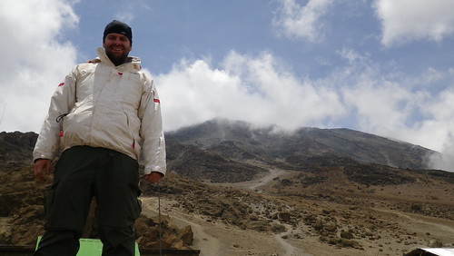
So, here is William, happy before the final ascent. Little does he know.
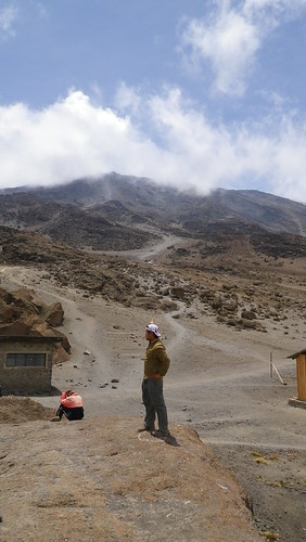
Here is me, calling my Babe Ruth shot. I think the mountain heard me, and as a result of my arrogance, decided to teach me a lesson. And boy, what a lesson it was.
I took this video to show how fast the clouds move this high up. Remarkable.
Surprisingly, there is a bit of nature up here. Above is a hawk we saw circling the encampment. Waiting to pick off dead trekkers perhaps (ha)?
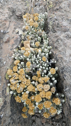
Here are some crazy dandelion like weeds rising from what looks like ashes.
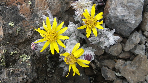
And here is some yellow, which is a welcome sight given all the drab surrounding it.
So, as Barack watches over us, William falls immediately into a deep sleep below (at 3PM in the afternoon). Sweet dreams William...
No real updates this week, so straight to the main event.
I took the video above to highlight one thing, and one thing only... our pace. As you can see, it's rather slow. This is by design. On average, we covered about 4 miles a day on the ascent. This is not a far distance. We would complete the hike in about three hours. The reason for the pace, however, was to slowly acclimate ourselves to the elevation. It is for this reason that our guides said that older people actually acclimate better than younger people - the younger people are pissing vinegar trying to go up the mountain as fast as possible, whereas the older people, whether due to their less rigorous physique or greater susceptibility to the wisdom of others, go at a slower pace. And it makes a huge difference. The guides know this, which is why they set this pace. You would think it would be frustrating, but honestly, we really didn't mind. Slow and steady wins the race - it's the tortoise and hare story all over again.
Okay. Short "lesson" this week. Back to the climb.
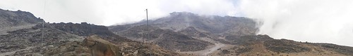
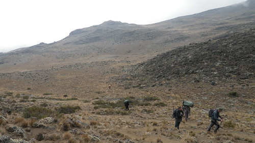
Today we crossed the Saddle. If you look at the topographical map of Kilimanjaro above, the Saddle is the portion between Mawenzi on the far right and Kibo in the middle. This was actually our longest ascent day, as we hiked six miles. While we only gained 1,300 feet in elevation, this was deceptive since at the beginning of the hike we actually lost about a 1,000 feet. So, it's more like a 1,000 foot elevation loss onto the Saddle, and a 2,300 foot gain on the Saddle. Luckily, the elevation drop was quick, but the elevation gain was very gradual, so the elevation gains by themselves weren't that unpleasant.
As the day broke, we left Mawenzi's crater and descended down to the Saddle, leaving Mawenzi shrouded in clouds (again) in the distance.
Here we are descending down.
We actually caught up to the British guys (in the distance in the photo above)...
... but then we took a break and they passed us right back. As did all of our porters. The guy in the middle with the green bag on his head is carrying Bill's bag, also known as the "Bodybag" due to its body-filling potential. Or at least a midget.
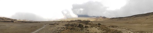
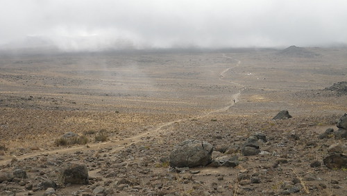
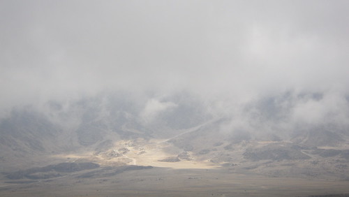
It wasn't before long, however, that the cloud cover came in, and our views of the Saddle "valley" disappeared.
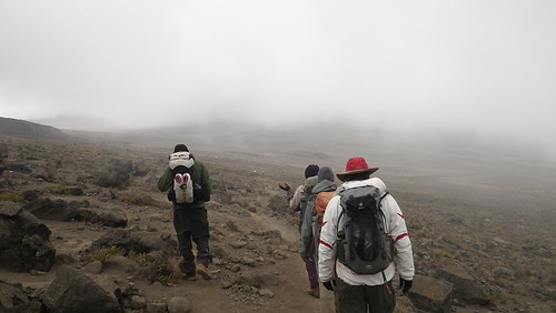
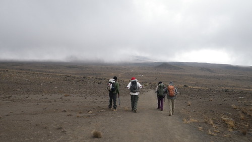
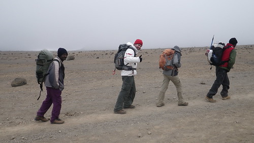
And we march on.
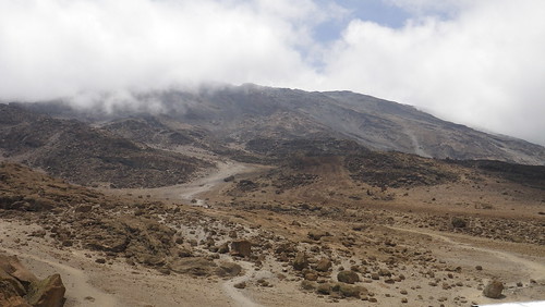
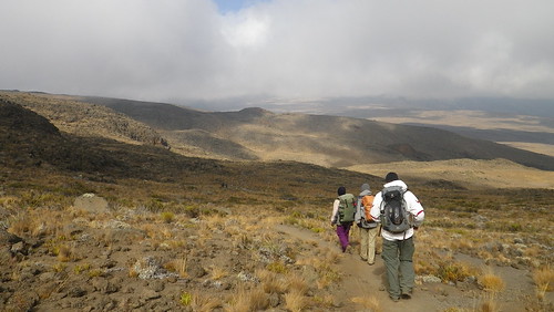
You can see the path to Kibo lay before us. One thing that surprised me a little is that while there was clearly some paths more worn than others, suggesting that these were the actual "trail" paths, there were actually a lot other paths branching every which way periodically on the trail. And there were no signs suggesting which way to go. In places like the Saddle on a clear day, I suppose the terrain view would point us in the right direction, but when there was vegetation and/or clouds, it would have been super-easy to get lost and go down the wrong path. Hence the importance of guides.
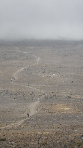
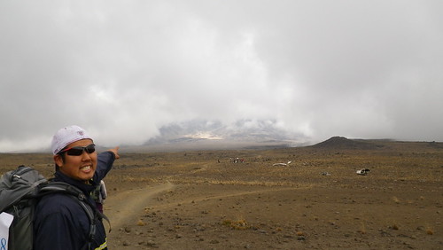
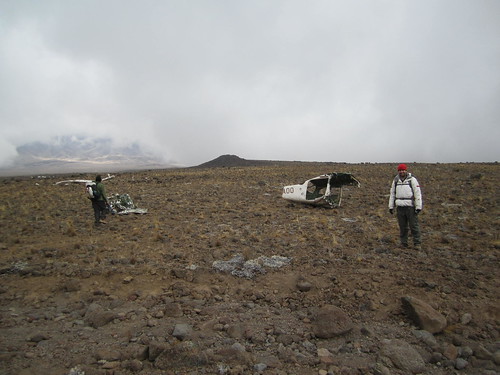
As we walked down the path to Kibo, we noticed a bunch of white objects in the distance.
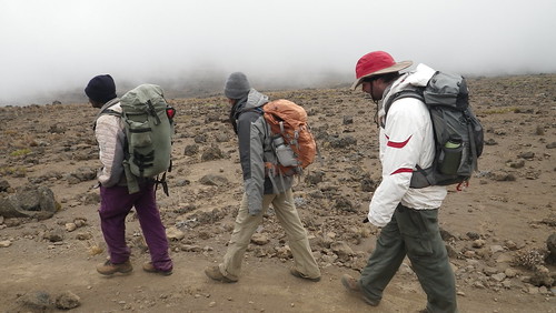
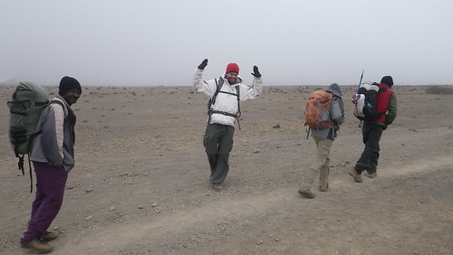
But what, oh what could they be? This is also where the path became wide enough for us to walk side-by-side, which was strange after days of single-file motion.
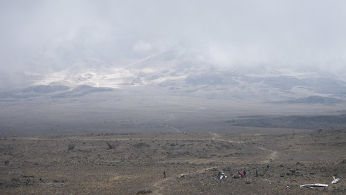
It was at this point that the clouds broke for just a second to show us our destination for the day - Kibo Hut. And the sun was shining on it, like a tantalizing jewel in the distance. Or something like that.
We were happy to see our eventual destination, even if it was still about 4 miles and 2,000 feet elevation gain away at this point.
A closer view of distant Kibo Hut.
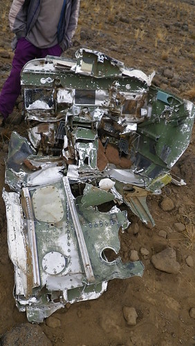
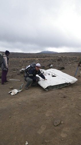
Anyways, back to the white objects. As we got closer, we could see that they were parts of some sort of aircraft. Ronald said that it crashed about ten years ago while crossing Kilimanjaro. It got lost in the clouds and lost track of how high the actual mountain is. After all, it is not uncommon for planes to fly at 19,000 feet. He thought it was a plane that crashed, but thought that it also could have been a helicopter. As we got closer, we could see why there was confusion. The fuselage to the right looks like it could belong to either.
This cockpit like portion, however, seemed to more suggest helicopter.
As did this fuselage portion, since it looked too big to be for the size of the plane it would have belonged to.
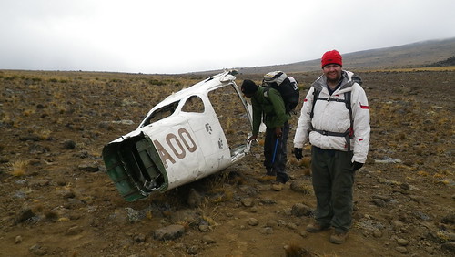
Same for this section that clearly belong to the rear-taper of the aircraft. Looking at the height, however, and the lack of anything that looked like rotor blades in the wreckage, we decided a plane made more sense. William with the wreckage.
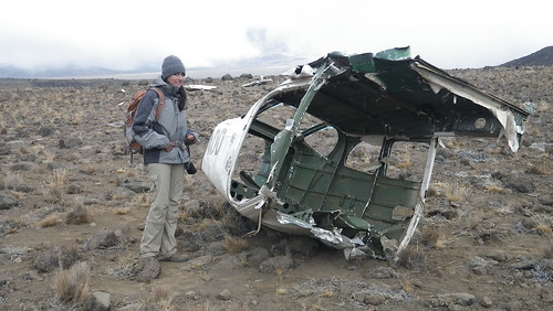
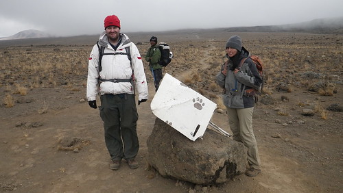
And Resha, with the slightly gruesome and eerie wreckage. Ronald didn't remember exactly, but he doesn't think there were any survivors on the flight. And since there really was no reason, or good means, to get the wreckage off the mountain, so it has stayed. And will continue to stay, for years to come. Probably last longer than the glaciers.
This has to be part of a wing right? For some reason, I felt some need to touch it.
We liked the paw-prints, so we guessed it was probably some sort of sightseeing flight that crashed. Which would make sense why they were so close to the mountain. Be forewarned!
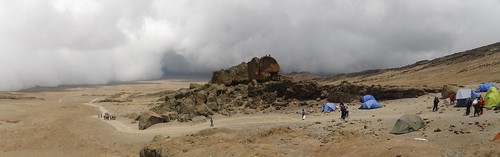
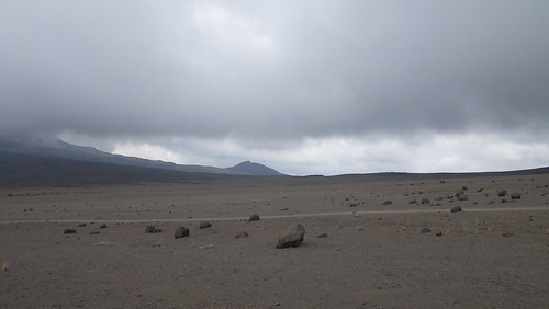
Anyways, this portion of the Saddle was really cool, just because it was so desolate. Almost completely flat for miles in every direction, the only thing that broke the landscape were this occasional rocks.
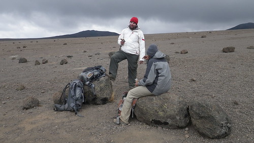
Conveniently, some were big enough for us to take a rest.
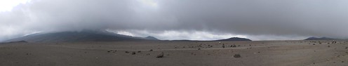
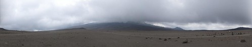
Some panoramas of the center of the Saddle seemingly equidistant from everything tall.
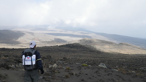
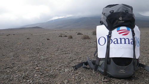
Barack and desolation.
It was about the last mile or so where the trail became noticeably steep. Coincidentally, it is at this point were we started getting really tired, what between the relatively long day, and the elevation - almost 16,000 feet!
Some rocky "directions."
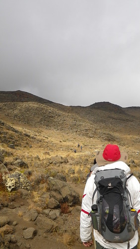
There were actually two parallel trails at this point, so I took the opportunity to hike on the "other" trail and take the photo from something other than behind everyone else. If you noticed that I was always taking pictures from the back, that's because in a standard trekking formation, the guide is at the front, and then the "weakest" hiker is directly behind the guide to set the pace for the whole group. For our group, that was nominally Resha, although I would dispute she was really the weakest, but until the last day, there was no question I was the strongest hiker. I am awesome. =) Sike.
Video of William's love (and Resha's hatred) of the clouds.
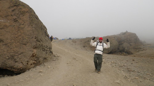
Cornholio on the Saddle (anyone else excited for the return of Beavis and Butthead?)...
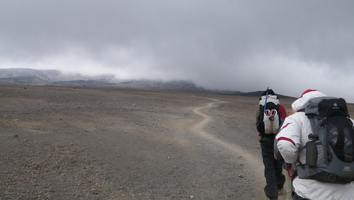
and Cornholio literally before the turn into Kibo Hut (which is to the left behind that rock).