... to Uhuru Peak is a bumpy one. But first, some satisfaction.
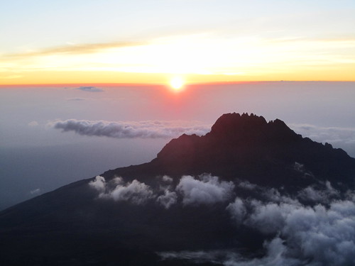
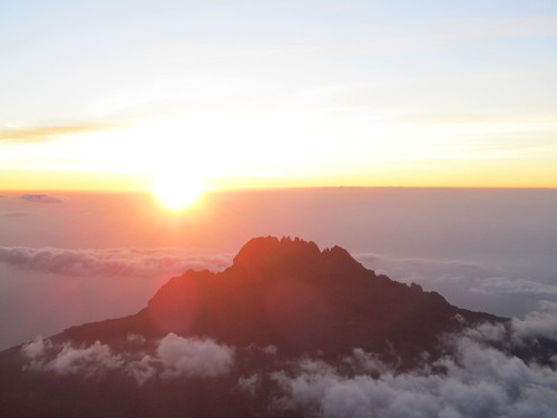
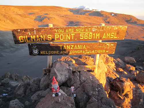
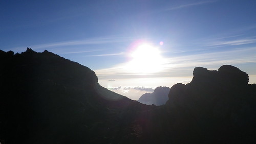
I can't really understate how ridiculously deliriously happy we were to make it to Gilman's Point to watch this sunrise.
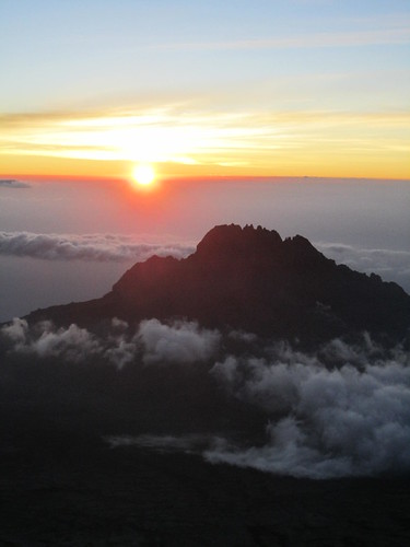
Even if we couldn't make it one step further, to see the red African sun rise over Mawenzi peak made the entire journey worthwhile.
I look forward to seeing more of God's creations that rival and eclipse what I saw that morning... but it may be awhile.
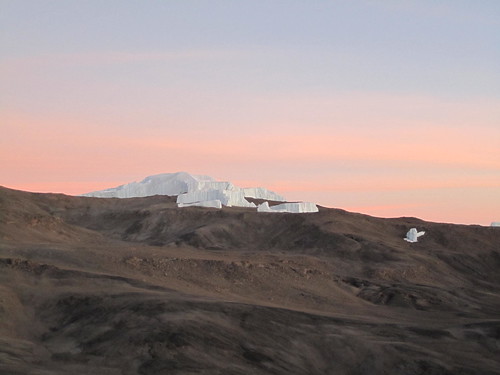
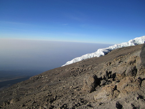
As we turned our eyes away from crater edge into the center of the caldera, we noticed something white in the distance. Ice! Icebergs! Glaciers! Hemingway's snows of Kilimanjaro! Unfortunately, due to global warming, all of our guides told us that the glaciers will disappear in ten to twenty years. Tragic. But selfishly then, I am glad I got to see them. Especially with the awesome, awesome pink sky behind it as the red dust from crater colored the morning sun.
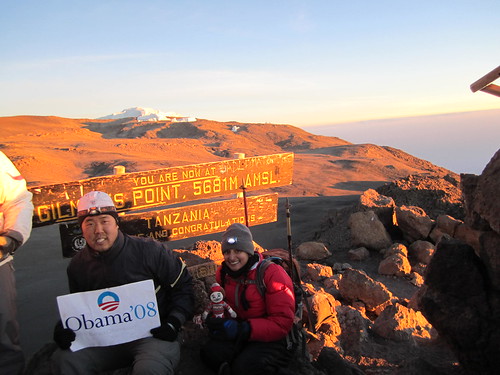
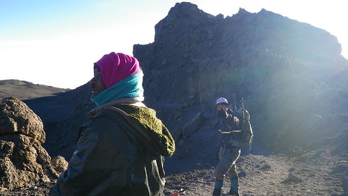
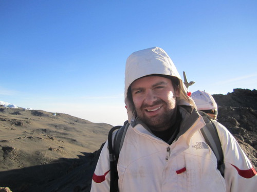
Of course, since we made it this high, we had to take advantage of the opportunity to take pictures as "proof." Here is William with his children "Terpy" and "Hokie."
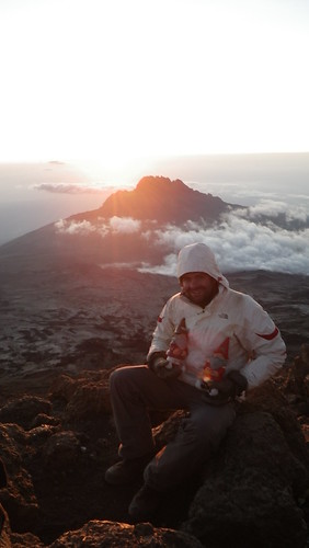
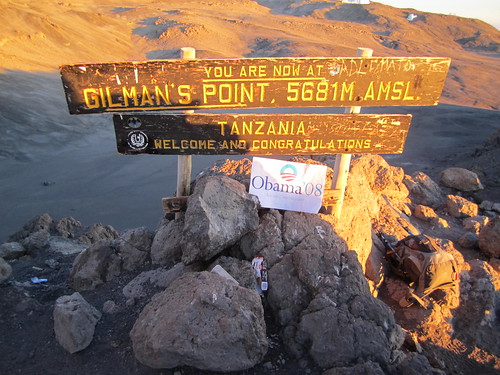
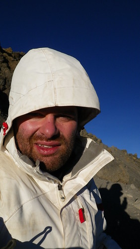
Here is me with Barack, and possibly Barack's long lost uncle cousin, Jonas. See the family resemblance?
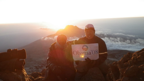
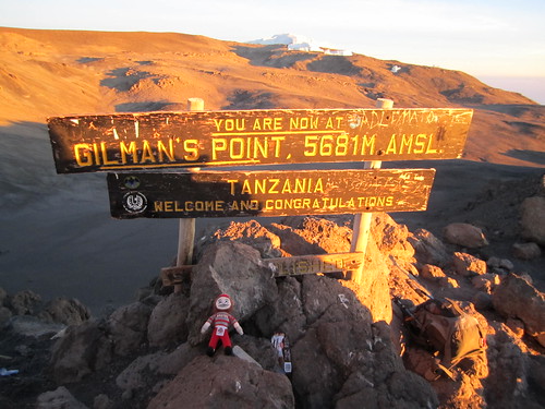
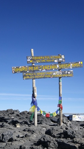
This is us at the sign, doubling up, since there was about a dozen people who wanted to take photos, so we had to be quick... at first.
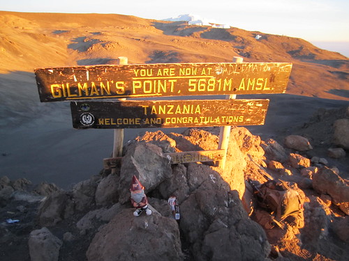
But then, the people left, so we took our time. This would have looked better without all the junk around the sign (a common theme, as you will see) but Hokie looks happy nonetheless.
As does Terpy.
And Brutus. Et tu Brute? Hehe. Had to say it.
And last but not least, Barack, looking a little crooked.
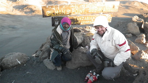
At this point, Jonas wanted to be in another picture (he was actually pretty pushy about it, which was sort of out of character, but we didn't mind, since he did get us to the top and all), so we did a last one with William.
At this point, Jonas asked us what we wanted to do. Our options were to (1) head on back down, since we technically did climb to the top, or (2) head to Uhuru Peak, the highest point on the mountain. While the journey to Uhuru would be flatter, it was still at least two hours each way, and we were at over 19,000 feet - funny things happen that high. Whether it was the high (pun intended) from getting to the top, or just our stubbornness at that point, we readily agreed to soldier on. And so we walked.
William agreed, but was a little more reluctant. But a trooper, nonetheless.
So, we headed down the path, which initially included this uphill between these rocks. Now, the path doesn't look that steep in this picture, and in truth it probably wasn't that steep. But that didn't matter. At 19,000 feet, you get only half the oxygen you do at sea level, so every step was painful. Seriously. It quickly got so bad, that I had to make a deal with myself to continue... for every twenty steps I took, I allowed myself ten seconds of rest. Without that pacing, no way I would have made it. Fortunately, none of us had the other symptoms of altitude sickness yet, except, of course, fatigue. We took frequent breaks about every twenty minutes, but we knew we had to get going while the weather was clear and before the afternoon gloom set in.
As we passed through the crack in the rocks, we saw another glacier, much closer this time. We also saw the path leading up from the Machame, Mweka, and Umbwe Routes and Barafu Hut below the glacier.
From what we could tell, the path up from Barafu Hut was longer, but less steep than from Kibo Hut. In fact, if you stood right where the paths met and look down, you could easily see Barafu Hut... and the little ants of people coming up the path. That was actually pretty cool.

Here is the panorama of this portion of the trek. As you can see, we are high enough that the horizon curves. While it is slightly exaggerated in this photo when I made the panorama, it's actually not that exaggerated, as I immediately noticed the curvature when we made it to the crater rim. It seemed surreal.
As you can see, William is happy about all this...
... as is Resha. I should note that Resha was the big trooper in all of this. Out of the three of us, while we she may not have been the strongest climber, on summit day, she fared the best out of all of us, keeping the briskest pace along the crater rim, and suffering the least in altitude sickness, despite taking less Diamox than the rest of us. Good job Resha!
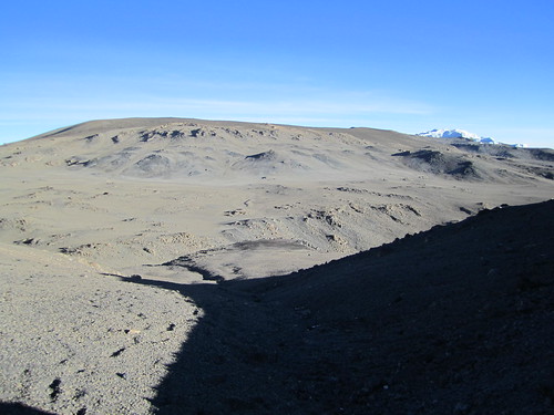
So, one of the things people ask is "how did the top look?" Well, obviously some of the photos I took were spectacular, but they were actually few and far between. Most of the time, the center of the caldera (with the central cone of steaming something in the middle) was the only thing, and boy was it ugly. Like REALLY ugly. Just brown dirt and brown rocks. Desolation at it's finest. This was actually one of my biggest disappointments.
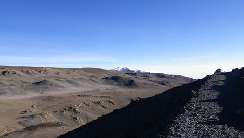
The dropoff from the path down to the floor of the caldera a few hundred meters below was actually pretty steep at times. We weren't in any immediate danger of falling over the side, but given that I was so fatigued and had the possibility of getting loopy, it was possible. And I didn't even want to contemplate what it would have taken to climb back up the crater rim if I had fallen down. I think I would have just laid there and let the porters come get me. Seriously.
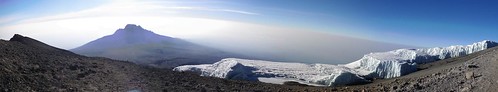
This panorama was the more spectacular view that we passed. On the right is the largest glacier we passed, and to the left is Mawenzi shimmering in the distance. Again. God I love Mawenzi. What an awesome peak.
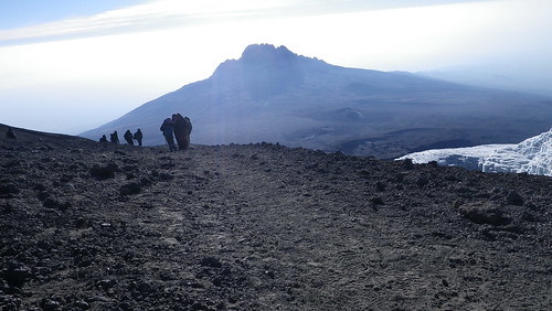
Some of our fellow trekkers coming around the bend in front of Mawenzi.

A panorama of the caldera bottom and, once again, how ugly it is. If you look closely, you can see a path roughly starting in the bottom middle of the photo, and then heading to the upper left. That wasn't our eyes playing tricks on us. One of the options on some of the treks is actually camping at the caldera bottom, and that is the path. Not many people do it, since even the caldera bottom is around 18,000 feet, and it really isn't advisable to spend that much time that high, but it is done. The campsite is approximately to the upper left, and joins our path at Gilman's Point on the right. When we were there, we are sure one group stayed in the caldera, because on our way down, we saw a bunch of porters jump (yes, jump) over the crater rim and then run down the path to Kibo Hut. With stuff on their heads. These guys were clearly the cream of the crop.
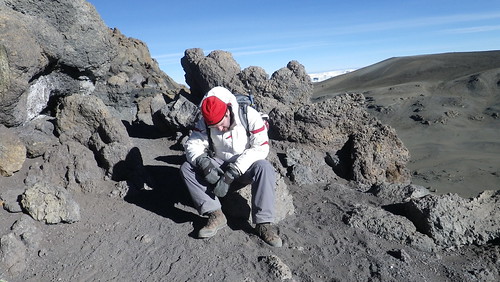
William, on the other hand, was not as buoyant.
Don't fear William! Have heart! The peak is but a short distance away...
No comments:
Post a Comment